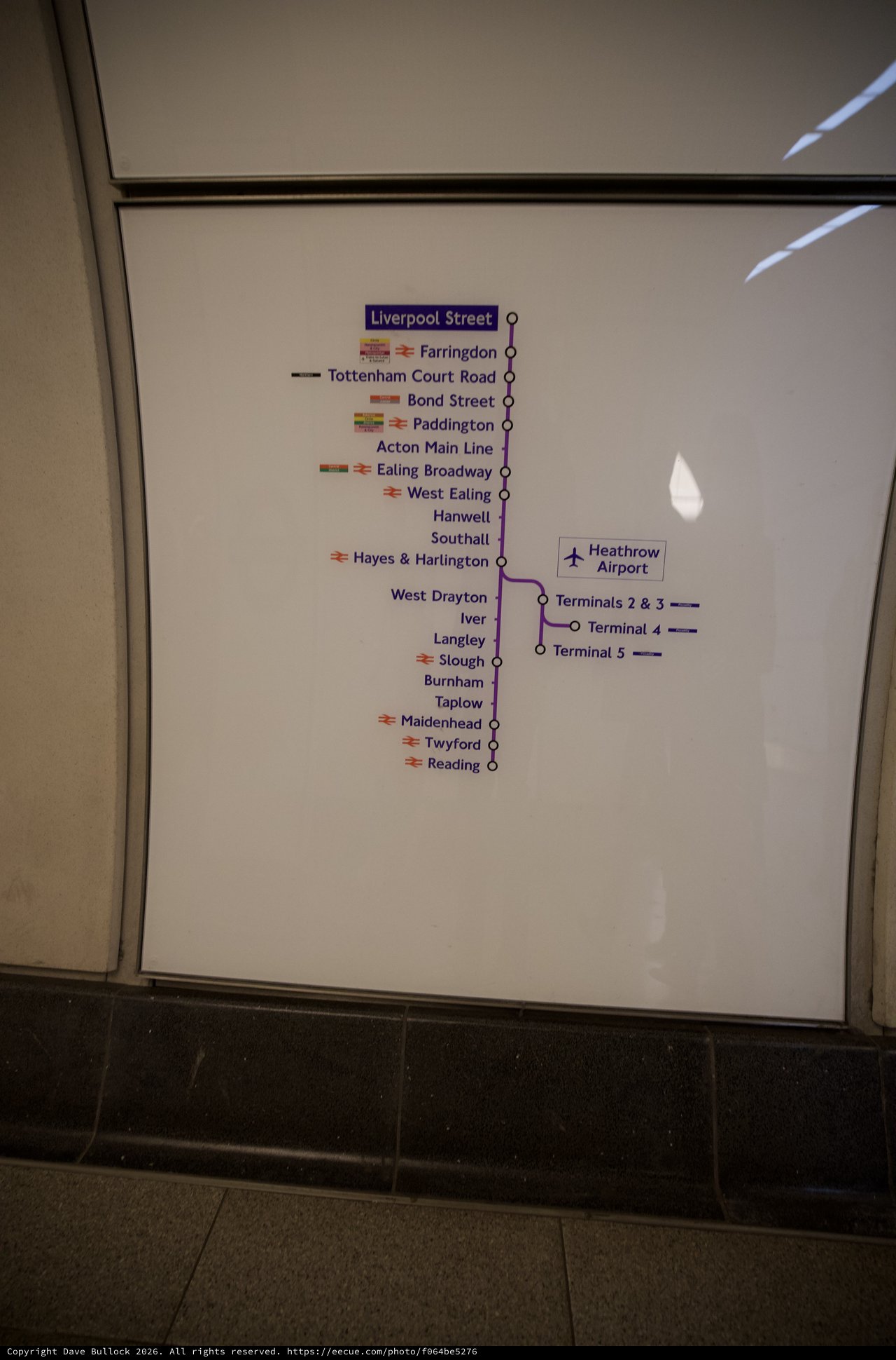
Elizabeth Line Railway Map at Station
Tuesday, March 10th, 2026 at 9:55:12 AM · 2026/London
This photograph captures a transit map affixed to what appears to be a train or station wall panel. The map displays the Elizabeth Line (Crossrail) route through London and beyond, showing major stations from Liverpool Street in central London through to Reading in the west, with branches to Heathrow Airport terminals. The map uses the characteristic purple line color associated with the Elizabeth Line and includes National Rail symbols at interchange stations. The image is taken at an angle, showing part of the beige/cream colored panel and dark flooring below.
Chronologically Adjacent