Photos | Navigating the City

Navigating the City

Caption

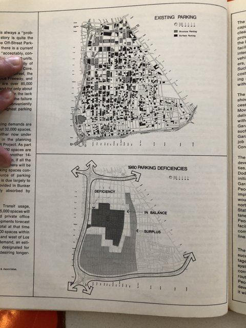
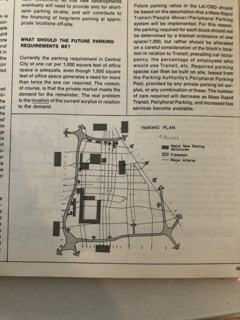
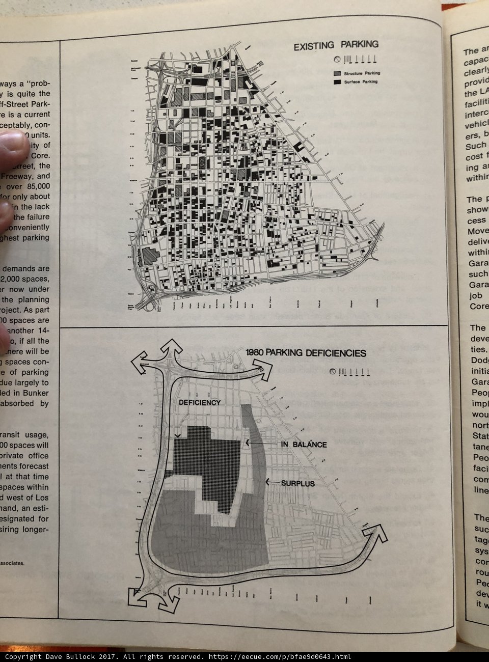
A hand holds a book filled with maps and diagrams to help plan routes and transportation options throughout the city.

BLIP-2 Description:

a book with maps of the city and a hand holding it

Chronologically Adjacent

Previous chronologically
Next chronologically
Note: You can also navigate with your arrow keys or swiping.

Metadata

Original Dimensions:

3024w x 4032h - (download 4k)

Dominant Color:

Detected Text

00  10  14  1980  2,000  85,000  9  a  about  absorbed  ai  all  an  and  another  are  as  at  b  balance  be  bunker  by  ceptably  cess  clearl  con  cor  core  cost  current  d  deficiencies  deficiency  del  deliv  demands  deve  dod  due  e  er  ers  esignated  esti  existing  f  faci  facilit  failure  for  forecast  freeway  g  gar  gara  ghest  i  if  imp  in  ing  initic  interc  is  ity  job  lack  land  largely  led  lents  li  line  longer  los  move  nere  nort  now  o  of  office  oject  only  onveniently  orivate  over  park  parking  part  peo  per  planning  prob  provic  quite  ransit  rou  show  siring  spaces  ssociates  stat  street  structure  suc  such  surface  surplus  tag  tane  that  the  ties  time  to  under  units  usage  utreet  vays  vehic  west  will  withi  within  withir  wou  y  сарас  
iso
40
metering mode
5
aperture
f/1.8
focal length
4mm
shutter speed
1/15s
camera make
Apple
camera model
date
2017-12-02T12:46:45.422000-08:00
tzoffset
-28800
tzname
America/Los_Angeles
* WARNING: The title and caption of this image were generated by an AI LLM (gpt-3.5-turbo-0301 from OpenAI) based on a BLIP-2 image-to-text labeling, tags, location, people and album metadata from the image and are potentially inaccurate, often hilariously so. If you'd like me to adjust anything, just reach out.