Photos | Mapping out the City

Mapping out the City

Caption

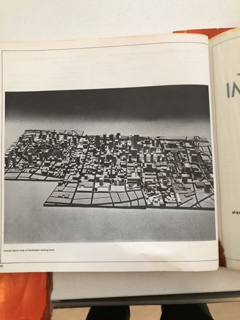
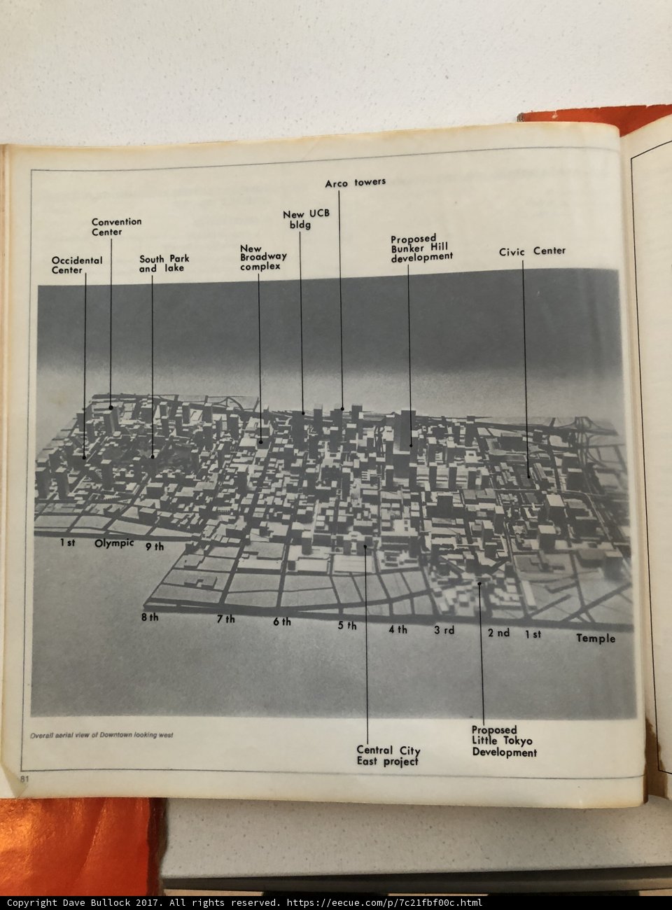
A publication showcasing a detailed plot of the city's waterfront, complete with diagrams and charts.

BLIP-2 Description:

a book with a map of a city on it

Chronologically Adjacent

Previous chronologically
Next chronologically
Note: You can also navigate with your arrow keys or swiping.

Metadata

Original Dimensions:

3024w x 4032h - (download 4k)

Detected Text

1  1st  2  3  4  5  6  7  8  81  9  aerial  and  arco  broadway  bunker  center  civic  complex  convention  development  downtown  hill  lake  looking  nd  new  occidental  of  olympic  overall  park  pipe  proposed  rd  south  st  temple  th  tokyo  towers  view  west  
iso
50
metering mode
5
aperture
f/1.8
focal length
4mm
shutter speed
1/15s
camera make
Apple
camera model
date
2017-12-02T12:48:38.359000-08:00
tzoffset
-28800
tzname
America/Los_Angeles
* WARNING: The title and caption of this image were generated by an AI LLM (gpt-3.5-turbo-0301 from OpenAI) based on a BLIP-2 image-to-text labeling, tags, location, people and album metadata from the image and are potentially inaccurate, often hilariously so. If you'd like me to adjust anything, just reach out.